Using Te Ara -
The Encyclopedia of New Zealand
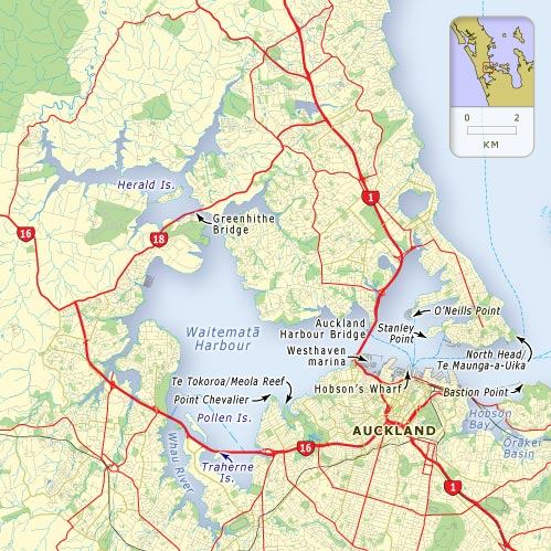
1. Waitemata Harbour
L.I. Develop our knowledge of Auckland and the Tamaki River.
Familiarise ourselves with an online NZ encyclopaedia.
Use our skimming and scanning skills.
What sort of landform is the Waitemata harbour?
The Waitemata Harbour is a drowned river valley ✔
Why was it chosen to be New Zealand’s capital?
It had deep water and sheltered bays. ✔
What does Waitemata mean?
It means obsidian glass.✔
Tell me one interesting fact about each of these features of the Waitemata:
Auckland’s chief port - In 1859 was the beginning of the first series of land reclamations to expand the port area. ✔
Viaduct basin - The viaduct basin was redeveloped in the mid-1990’s. It was then a site where the America's Cup could be hosted by the Royal New Zealand Yacht Squadron in 1999 and 2003.✔
Westhaven -Westhaven is the largest managed marina in Australasia ✔
Harbour bridge - The harbour bridge is 1,020 m long. ✔
Greenhithe bridge -The Greenhithe Bridge was built as an alternative harbour crossing in 1975. ✔
Natural features - The natural features also include the Meola reef and a rocky sub-marine promont. ✔
Map of the Waitemata Harbour
No comments:
Post a Comment
Note: only a member of this blog may post a comment.